

There’s a particular kind of satisfaction that lives at the top of San Gabriel Peak. Not the explosive rush of a technical climb or the distant glory of an 8,000-meter ascent — but something more personal, more earned. At 6,161 feet above sea level, this peak in the San Gabriel Mountains of Southern California offers one of the most rewarding day hikes in the region: a trail that’s challenging enough to feel like an accomplishment but accessible enough to transform first-time peakbaggers into lifelong mountaineers.
It’s the kind of hike that changes people. Not because it’s the tallest or the most remote or the most photographed, but because on a clear winter morning, when the city sprawl below dissolves into a patchwork of rooftops and the Pacific Ocean shimmers at the edge of the horizon, San Gabriel Peak quietly becomes something extraordinary.
Where Exactly Is San Gabriel Peak?
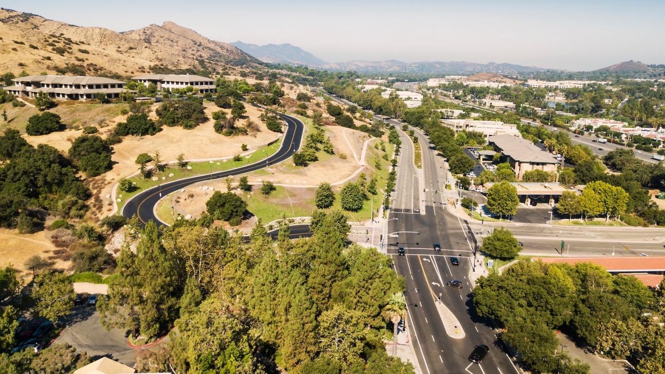
San Gabriel Peak sits within the Angeles National Forest, roughly 30 miles northeast of downtown Los Angeles. It’s part of the San Gabriel Mountains range — a dramatic spine of rock and chaparral that most Angelenos see daily from the freeway but rarely explore on foot.
The standard trailhead begins at Mount Wilson Red Box Road, accessible via the Angeles Crest Highway (Highway 2). The mountain is technically located within the Mount Wilson Ranger District, and the usual approach passes through or near Eaton Saddle, depending on the route chosen.
Its coordinates put it in a particularly photogenic slice of the range — close enough to the developed Mount Wilson Observatory area to benefit from decent road access, but far enough off the main tourist circuit to retain a sense of genuine wilderness.
Getting There: The Logistics That Actually Matter
Before lacing up your boots, there are a few things worth knowing about accessing this trail.
A National Forest Adventure Pass (or Interagency Annual Pass) is required to park at most trailheads in the Angeles National Forest. At the time of writing, day passes are available at ranger stations and select outdoor retailers, and the fines for non-compliance aren’t worth testing. Pick one up before you go.
Angeles Crest Highway closes during winter storms and can remain shut for extended periods after heavy snowfall. Always check Caltrans and Angeles National Forest road conditions before making the drive. There’s nothing more deflating than arriving at a gate 15 miles from your trailhead.
The most popular starting point is Eaton Saddle, reached by driving east on the Angeles Crest Highway from La Cañada Flintridge. From there, the trail to San Gabriel Peak is just over 1.5 miles one way — short enough to look deceptively casual on paper, but with enough vertical gain to remind you that elevation doesn’t lie.
The Trail Itself: What to Expect Mile by Mile
The First Push from Eaton Saddle
The hike begins at Eaton Saddle (approximately 5,570 feet), which already puts you well above the smog layer on most days. From the saddle, the trail heads east along a fire road briefly before forking toward the PCT (Pacific Crest Trail) connector and eventually to the summit use-trail.
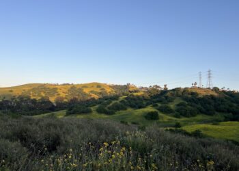
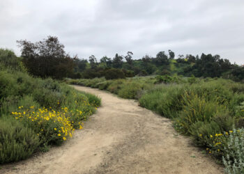
The early miles are wide and relatively gentle — this is chaparral country at its finest, with manzanita pressing in from both sides, its reddish bark glowing in the morning light like polished wood. The path feels generous here, inviting even.
The Intersection With Mount Disappointment
You’ll pass near Mount Disappointment en route — one of those wonderfully named peaks that actually delivers something of a view despite its self-deprecating title. At 5,994 feet, it’s lower than San Gabriel Peak but sits on a ridge that offers its own compelling angles on the surrounding terrain.
Many hikers bag both summits in the same trip, which adds roughly half a mile and minimal time to the total outing. Given that you’re already there, it would be a shame not to.
The Final Climb to the Summit
The push to San Gabriel Peak’s true summit requires a short but steeper scramble on a use-trail. The terrain shifts underfoot — looser soil, more exposed rock, the kind of surface that makes trekking poles earn their weight. The trail narrows. The views expand. The chaparral thins.
And then you’re there.
The summit is marked by a benchmark disk and often a small summit register — a notebook stuffed in a metal canister where hikers have been leaving their names, dates, and the occasional love note to the mountain since before the era of GPS coordinates and Instagram posts.
What You’ll See From the Top
Let’s be direct: the views from San Gabriel Peak are among the finest achievable on a sub-half-day hike in Southern California.
On clear days — which occur most frequently from November through March, after storms scrub the atmosphere clean — you can see:
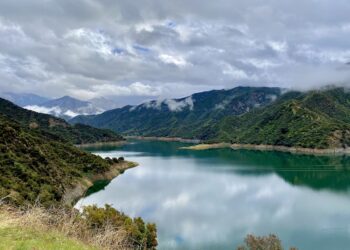
To the south: The entire Los Angeles Basin stretching toward the Pacific Ocean. On exceptional days, Catalina Island materializes on the water like a rumor confirmed. The urban grid of millions of people sprawls below you in perfect silence.
To the north and east: The high desert, Antelope Valley, and if conditions are particularly crystalline, the Mojave. The San Bernardino Mountains rear up to the east, and on the finest winter mornings, the snowy peaks of Mount San Gorgonio and Mount San Jacinto — both over 10,000 feet — stand with remarkable clarity.
To the west: The Santa Monica Mountains, the Santa Susana range, and the hazy smear of the Pacific Coast from the Santa Monica Bay stretching north toward Malibu.
What makes these views so emotionally resonant isn’t just the distance — it’s the contrast. You’ve driven through the traffic, felt the weight of city living, and now you’re above it all. Literally. The summit teaches perspective in the most direct way possible.
When to Go: A Seasonal Guide
Winter (December–February)
This is peak season for San Gabriel Peak, and the wordplay is entirely intentional. Snow is possible — sometimes dramatic — and the summit can feel genuinely alpine. Post-storm conditions reveal a transformed landscape: white-dusted chaparral, icy patches on the trail, and views of impossible clarity.
Hikers should carry traction devices (microspikes or similar) and check road conditions before heading out. The payoff, when conditions cooperate, is the single best experience this peak offers.
Spring (March–May)
Wildflowers push through the chaparral, temperatures moderate, and the days lengthen. Trail conditions are generally excellent. This is the sweetest window for casual hikers — warm enough to be comfortable, cool enough to hike in comfort, and often still clear enough for quality views.
Summer (June–August)
This is the most popular season by visitor count but the least rewarding by most measures. Afternoon heat is genuine — the mountains sit above the coastal marine layer but still absorb the California sun directly. Start before dawn, hit the summit by 9:00 a.m., and you’ll avoid both the heat and the crowds. Views are typically hazy. The experience is still worthwhile; it’s just working harder for less.
Fall (September–November)
A transitional season with highly variable conditions. Early fall can carry summer’s heat and haze. By November, however, the first cold fronts sweep through and conditions can rival winter at its finest. The chaparral shifts in color, taking on warm amber and burgundy tones that give the trail a surprisingly autumnal personality for Southern California.
Flora and Fauna: The Other Reasons to Look Around
San Gabriel Peak’s terrain isn’t just a stage for views — it’s a living ecosystem worth slowing down for.
Chaparral Ecology
The slopes below the summit are dominated by classic Southern California chaparral: chamise, mountain mahogany, and the omnipresent manzanita, with its sculptural branches and smooth bark ranging from deep burgundy to rust-orange. After a fire — and this region burns — the chaparral regenerates with startling speed, often sprouting from the root crown within weeks.
Toyon (Heteromeles arbutifolia), the plant that allegedly gave Hollywood its name, grows here in abundance and bears clusters of bright red berries through the winter months.
Wildlife
The Angeles National Forest supports a healthy and diverse wildlife community, and San Gabriel Peak’s corridors see their fair share of it.
California mule deer are common enough that encountering one on the trail barely raises a hiker’s heart rate anymore. More exciting: mountain lions do inhabit this range, though sightings are rare and attacks on humans rarer still. Coyotes are frequently heard and occasionally spotted, usually at dawn or dusk.
Raptors use the ridgeline thermals with elegant efficiency. Red-tailed hawks circle at eye level when you’re on the summit. During migration periods, golden eagles pass through. In winter, an occasional bald eagle has been documented in the broader San Gabriel watershed.
On the smaller end of the spectrum, the chaparral supports California towhees, scrub jays in their characteristic blue-and-gray, and during summer evenings, the chorus of Pacific tree frogs rises from any drainage that holds water.
The Elevation Advantage: Understanding the Mountain’s Geology
The San Gabriel Mountains are geologically young — at least by the standards of a landscape measured in millions of years. They’ve been dramatically uplifted by movement along the San Andreas Fault and related fault systems, which is why the range rises so steeply from the Los Angeles Basin floor. The escarpment from valley to ridgeline represents one of the sharpest elevation transitions in the contiguous United States.
The rock you’re walking on is predominantly granitic and metamorphic in origin — the same ancient material that forms the backbone of the broader Transverse Ranges. This is why the soil is coarse, the drainage fast, and the slopes prone to slipping in wet conditions. It’s also why the ridgelines, stripped of finer soil by wind and water, have that clean, sculpted quality so distinctive from the summit.
San Gabriel Peak’s position on a southwest-facing ridge means it catches full sun for much of the day in summer and is among the first summits to lose its snow in winter — except on its north-facing aspects, which can hold snow well into March.
Practical Gear and Safety Information
The Ten Essentials (Abbreviated for Context)
San Gabriel Peak is not a technical climb, but it’s not a casual stroll either. The smart approach includes the basics:
Navigation: A trail map and compass (or downloaded offline GPS map) for a hike this short may feel like overkill until it suddenly isn’t. Cell signal is unreliable on the approach trails.
Water: Two liters minimum for the round trip. There are no reliable water sources on the trail. Dehydration at altitude is faster than most people expect.
Layers: Even on warm days, a wind layer is essential at the summit. Conditions at 6,161 feet can shift quickly, particularly if afternoon clouds develop.
Sun protection: Above the chaparral canopy, there’s no shade. UV exposure at elevation is significantly higher than at sea level.
Traction devices: In winter, microspikes are essential rather than optional. The Angeles Crest approach roads and upper trail sections ice over after storms.
Permits and Regulations
No advance permit is required to hike San Gabriel Peak under normal circumstances — the Adventure Pass covers parking, and the trail itself is open to day hikers. Group size limits and fire restrictions apply during fire season, which can extend from April through late November in drought years. Check the Angeles National Forest website before your visit for current conditions and restrictions.
The Culture of the Summit: Peakbaggers and History
San Gabriel Peak has a documented place in Southern California’s peakbagging culture. It appears on the Hundred Peaks Section list maintained by the Sierra Club — a project that has been sending hikers into the San Gabriel Mountains and surrounding ranges since the 1950s. Completing the full list requires summiting 100 peaks in the region, and San Gabriel Peak is a perennial early entry on most people’s journey through the catalog.
The summit register, maintained informally by the hiking community, contains decades of entries from people who’ve made this climb for every conceivable reason: first hikes after major illness, memorial climbs for loved ones, solo birthday outings, and the joyfully mundane record of a father and daughter who come every New Year’s Day without fail.
There’s something quietly democratic about a summit everyone can reach. The technical barriers are low; the rewards are high. This is a mountain that doesn’t discriminate by age, athleticism, or experience level — it only asks that you show up and keep moving.
Pairing San Gabriel Peak With Nearby Destinations
Mount Wilson Observatory
Just a few miles east on Angeles Crest Highway, the Mount Wilson Observatory offers a compelling complement to the physical challenge of the hike. Established in 1904 and home to the famous 100-inch Hooker Telescope — the instrument Edwin Hubble used to establish that other galaxies exist beyond the Milky Way — it’s open to visitors on weekends. Few days in the San Gabriel Mountains can top: summit in the morning, cosmos in the afternoon.
Chilao Visitor Center
Located further east on the highway, Chilao offers camping, a visitor center with interpretive displays on the range’s ecology and fire history, and several moderate loop trails. It works well as a base camp for multi-day exploration of the central San Gabriels.
Eaton Canyon
Back down in the foothills, Eaton Canyon Natural Area presents a very different face of the same mountain range — a riparian canyon system with a seasonal waterfall and year-round bird activity. It functions as an excellent post-summit destination if the legs have more to give.
Why San Gabriel Peak Matters More Than Its Elevation Suggests
At 6,161 feet, San Gabriel Peak will never appear on a list of California’s highest points. It doesn’t carry the mythological weight of Mount Whitney or the technical reputation of the Palisades. It doesn’t require a permit lottery or a week of preparation.
What it offers instead is something rarer and arguably more valuable in a densely populated, relentlessly busy metropolitan region: accessible wildness. The ability to step off the Angeles Crest Highway, put one foot in front of the other for ninety minutes, and arrive at a point where the city that contains most of your life becomes a texture on the landscape far below.
The San Gabriel Mountains exist in a unique cultural role for greater Los Angeles. They are the backyard of tens of millions of people who rarely visit them, a frontier sitting at the edge of the most urban environment in the American West. San Gabriel Peak is perhaps the best single ambassador for what that backyard contains — the clearest argument for returning, and returning again, until the mountain feels like home.
Final Thought: Go Before You’re Ready
The most common regret among hikers who’ve finally made the climb to San Gabriel Peak is that they waited so long to do it. Too busy. Too out of shape. Too uncertain about the right gear, the right season, the right conditions.
None of those hesitations hold up once you’re standing on the summit with the Pacific at your back and the desert in front and the whole enormous, complicated city glittering below. The right time was last month. The second right time is now.
Pack water. Check the road conditions. Grab your layers. The mountain has been there for millions of years and it will be there next weekend — but the particular morning you’re reading this, with whatever sky is overhead and whatever season is turning, will only happen once.
San Gabriel Peak is located within Angeles National Forest, Los Angeles County, California. All hikers must comply with current Angeles National Forest regulations, including Adventure Pass requirements and fire restrictions. Trail conditions and road access vary seasonally — always check official sources before your visit.


